Saturday, April 30, 2016

Three Things I Love About Eastern Samar


Borongan is 4 hours away from Tacloban, where the airport is.  But the view compensates for the long travel.  On one side would be mountains, and on the other side is the Pacific Ocean and a nice view of some tiny white sand islands or limestone reefs.There are also the beautiful rivers and huge rice fields Despite the many surfers coming from different countries, the beaches of Eastern Samar remains to be very clean, and not commercialized. There are many coves, where one can just go to swim for free or for a very minimal fee.


One thing I love about Eastern Samar is its clean waters, and huge tract of mangroves, which help support a healthy marine ecosystem.  One early morning, we woke up at 5:30 in the morning to go swimming in one of the coves.  I am not sure where it was but it was just by the bridge going to Calico-an island.  The cove has coral reefs which was bombed during the World War 2 and the hole caused by the bomb formed pool-like hole. To this day, different schools of fishes still live in that “pool”.  People go there to swim – together with the fishes. I hope they will be able to keep the place as it is now. 


Another favorite is the very delectable crabs from a village called Caridad.  It was the yummiest I have ever tasted – sweet and very fresh. This also shows how healthy their marine ecosystem is.


And third favorite is the beautiful sunset  which is something I cannot get enough of.


Eastern Samar is now one of my favorite islands in the Philippines.  I travelled for work and did not have much time to see the famous sites. I did not see Linao cave which is one of the most enchanting caves and waterfalls I have seen in the pictures.  I am going back for Linao cave and for the white sand islands, someday soon. 

Friday, April 8, 2016

Beautiful Eastern Samar

Last week, my work took me to Samar Island in Visayas.  I was expecting the area to still be reeling from the effects of Typhoon Haiyan, one of the strongest and most destructive typhoon that hit the earth more than 2 years ago.  However, during the 4 hour drive from Tacloban to Borongan, I cannot help but notice the lush hills.  As if nothing happened.  Except for a few ruins of what used to be houses or buildings. 

On the way to Samar..at the San Juanico bridge, which connects the 2 island provinces of Samar and Leyte.

But I am only talking about the vegetation and infrastructure in the area.  I could not talk about the emotional scar left by a typhoon which left around 6,000 people dead. Nor the trauma encountered by the surviving residents having to watch, in shock, the raging water eat up their villages, their houses, their everything, Or of having to helplessly watch their neighbors, friends and family disappear in the water or carried by the wave to the open sea.
Harvest time...

But I would like to talk about how resilient the people in Samar are.  And how help came from all over the world to help them get back on their feet, and start to live their lives again.

The weavers of Basey, Samar..back to doing what they do best.. weaving the best, the most colorful mats.

The vegetation has grown back.  The landscape is as beautiful as it was before the typhoon, except for a number of “dead” coconut trees. And it is a reflection of how the province was able to rise above the calamity. Many people have already had their houses fixed, and are carrying on with their lives, despite their losses.  For those who cannot afford to build their houses, there were many organizations (both local and international), governments (ours and other countries), corporations and many individuals who helped build houses and latrines- either in their communities, or in relocation sites. They also now have more, and better, school buildings.  Roads have been fixed.  And this was made possible by the many people and organizations all over the world who extended their help. 

The lone boatman....

I visited 2 of the villages and while they still talk about their experience during the Typhoon, they were more eager to express their appreciation for the help they received. I cannot help but be proud about what our organization has done.  Through the help of our many donors, we were the first, among the many, to bring help to these 2 villages and many other villages. We distributed food, cooking and eating utensils, and also hygiene kits.  We likewise provided them with temporary housing, right after the typhoon, as well as supported them with counselling to help them, especially the children, overcome the trauma. We also gave the families a chance to earn through cash-for-work program, which ran for 1 month, where they help clean up the debris in exchange for compensation. After the relief operations, many organizations (including ours) also embarked on rehabilitation initiatives.  Houses, latrines, roads and schools have been built or rehabilitated.  Livelihood programs were also carried out to help them recover financially. All these were done through working together with the people in these communities, and with our donors, including those who do not even know where Philippines is. 

One of their beautiful rivers...

This trip to Eastern Samar has showed me what beauty meant... it's not only about the limestone mountains, islands and beaches. It is about the beauty of those who choose to rise above their situation.  And the beauty of being a part of a global community of kind hearted individuals who, maybe unknown to many of them, have left an imprint of their kindness all over Samar.   


Beautiful, beautiful sunset...

Wednesday, April 6, 2016

Calinawan Cave, Tanay, Rizal

I have never heard of Calinawan Cave, until my 8 year old nephew, who is into outdoor activities now, planned to do some trekking and caving.

Calinawan cave is in Tanay, which is but an hour ride away from home.  We headed to Daranak Falls, which is the jump off point.  There were way too many people at Daranak Falls during holy week, and we reminded ourselves never to go there again during Holy Week.  We wanted to back-out, but nephew prevailed (of course). 

The good thing is, most of the people there only wanted to be by the falls- and were not interested in the cave.  We signed up for the trekking and cave tour at the booth, which is a few meters away from the entrance to the falls. The guide showed us the trail to the cave, which is a 30 to 45 minutes uphill trek.

And he just keeps on going...and going..and going..and going...


We reached the cave- and there was a kiosk where we hired another guide to the cave.  The cave tour is run by the descendants of the person who discovered it. It was discovered during the Spanish colonial time and the family has donated it to the government, but the government is not acting on it so until then, they will continue to run the tours to the cave.

The cave is not impressive at the outside.  It looked like a mound of unimpressive stones with a small opening.  The guide lent us flashlights and we went down the opening.  

But we were surprised how big it is inside. We found ourselves in a big hall and the guide shared with us how the cave was discovered by his ancestor. Calinawan cave was where the Americans and Filipinos secretly meet during the Spanish-American war.  It was where they “settled” (nagcalinawan) and signed off on the details of their agreements. Another account says that here is where the Filipinos realized (nalinawan) that they wanted to be a free people. The guerillas hid there during the World War 2, and so did the 200 Japanese before they were cornered by the Filipinos and American soldiers. 

At the mouth of the cave

Inside the caves, there are different rock and stalactite/stalagmite formations.  (I'm sure there will be a lot more if you let your imagination run wild). At the entrance is the eerie looking face which the guide calls as “The Face”. It stands at the entrance like the guardian of the cave. 


The Face..up close


The Face

Further is a big column, of course called "The Column". "When the stalactite/stalagmite meet, they form the column". This one took millions of years to form.

Our guide by The Column
To the right of The Column is The TRex. 

The mighty T-Rex

Further up, is the beautiful and impressive Grotto. It does look like the scene of the apparition of The Lady.

The Grotto

There is also The Curtain and another which looked like an aquarium.  Beside the aquarium is The Volcano. 

By The Curtain

The Volcano eruption


And of course, this hole the shape of a heart, which the guide jokingly calls as The "May Forever".
Yes...Forever exists..

Guests can explore levels 1, 2,3 and 4 of the cave .  There is a level 5 where the bats live.  We had children with us, so we opted only for levels 1 and 2- which took us more than 30 minutes to explore. 

What used to be bat caves..before they got disturbed by people and they had to move to the lower levels of the cave. 


And finally.. The Exit
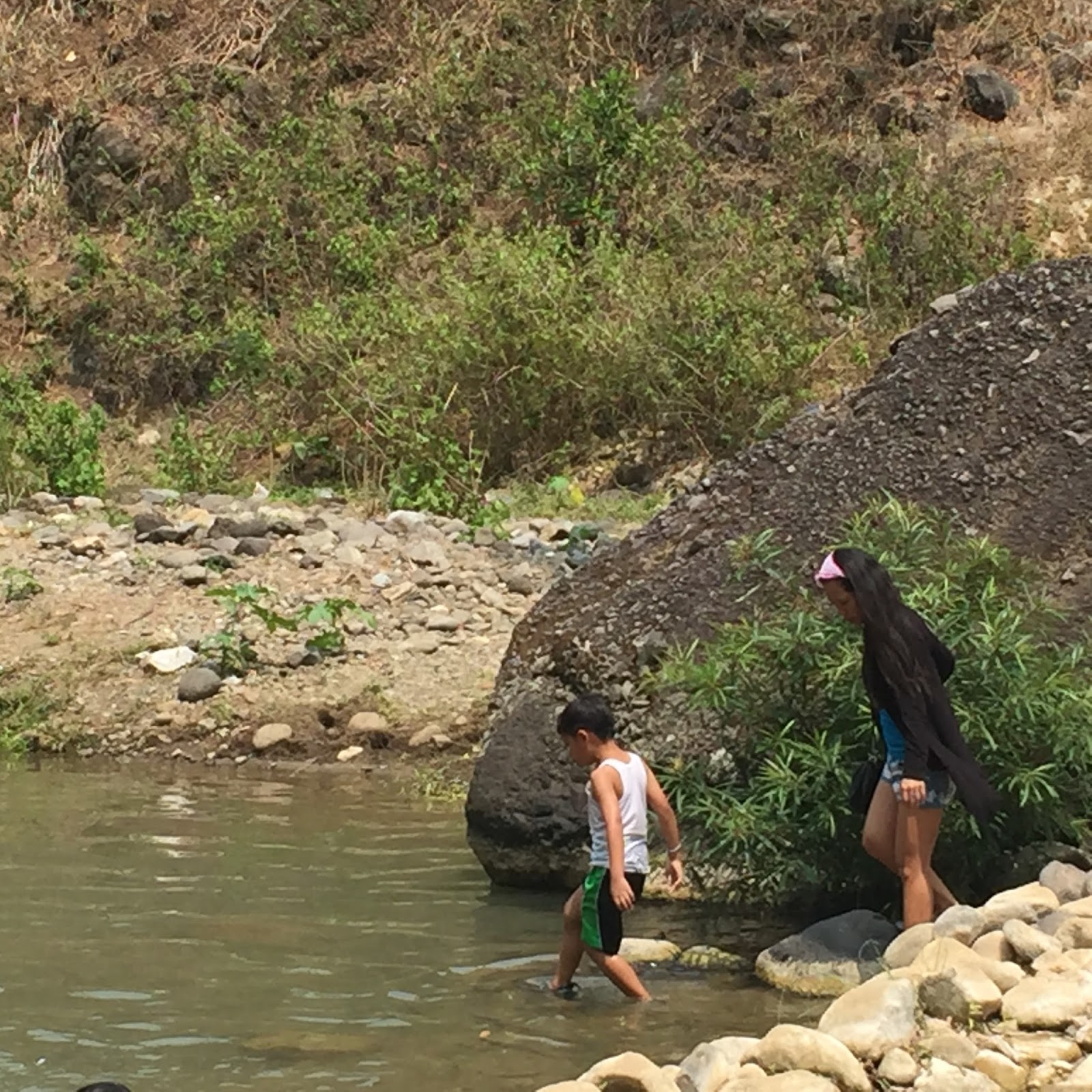


After the cave, we met with our first guide and did the river trekking- which was a lot of fun for my nephew. 


It was a fun day-despite the heat.  My nephew and 1 year old niece survived (and enjoyed) their first cave experience.  Looking forward to more outdoor activities with these two!